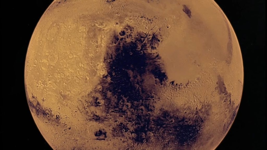
Above dark spot is the darkest large spot of Mars. This dark spot covers about 5 million kilometer square, which is around half the surface area of the United States. It is encompassing an area that is a shield volcano in the northern hemisphere while in the southern hemisphere, it is encompassing a crator filled terrain. The name of that shield volcano is Syrtis Major. It has a diameter of about 1,100 kilometers.
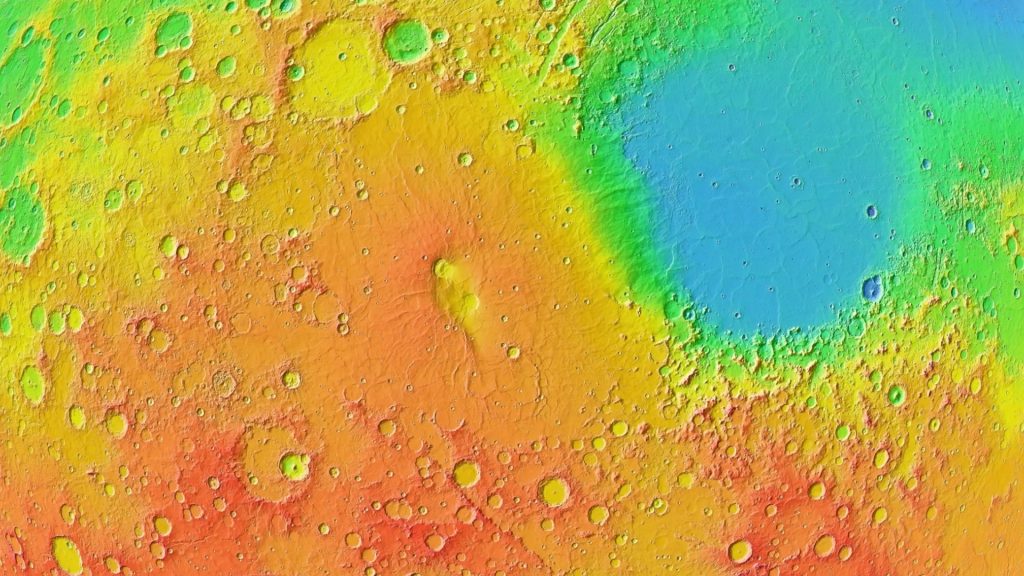
Although not visible in real color, it is visible quite well through a topographic map as seen in above image, which reveals a large surface without many craters. The surface slope is also very slightly slanted at 1 degree or frequently even less and that very slightly slanted surface slope over 550 kilometers goes up to the highest point in the center of the volcano at around 2,400 meters above the Martian datum which is the 0 meter reference point for Mars.
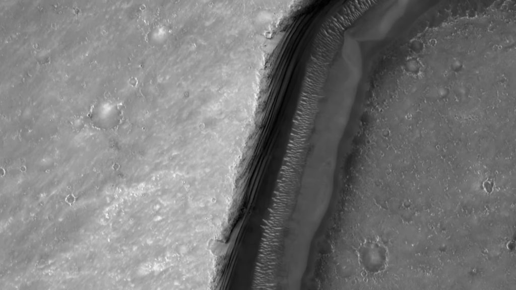
The terrain on this shield volcano is filled with wrinkle ridges. What exactly causes these is not certain, one idea is that they are created due to tectonics. This region also has multiple valleys, the one in above image is 600 meters wide and on the walls of the valley is bizarre look looking pattern.
In the center of the shield volcano, there are two calderas as seen in the image above. Calderas form when the magma chamber below the surface is emptied then the surface above the magma chamber collapses into the chamber which forms a circular depression. In the case of the Syrtis Major shield volcano, it has two of them, both are around 50 Kilometers in diameter and both are around 1 to 2 kilometers below the surrounding Plateau.
It is estimated that these calderas are around 3.5 billion years old. So they formed about 1 billion years after the formation of Mars. However, a topographic map reveals another feature present in the region, a mega Caldera encompassing both of the smaller calderas. It does not have sharp edges, so it is not very easy to spot it in real color but a topographic map reveals a somewhat circular depression some 200 kilometers across.
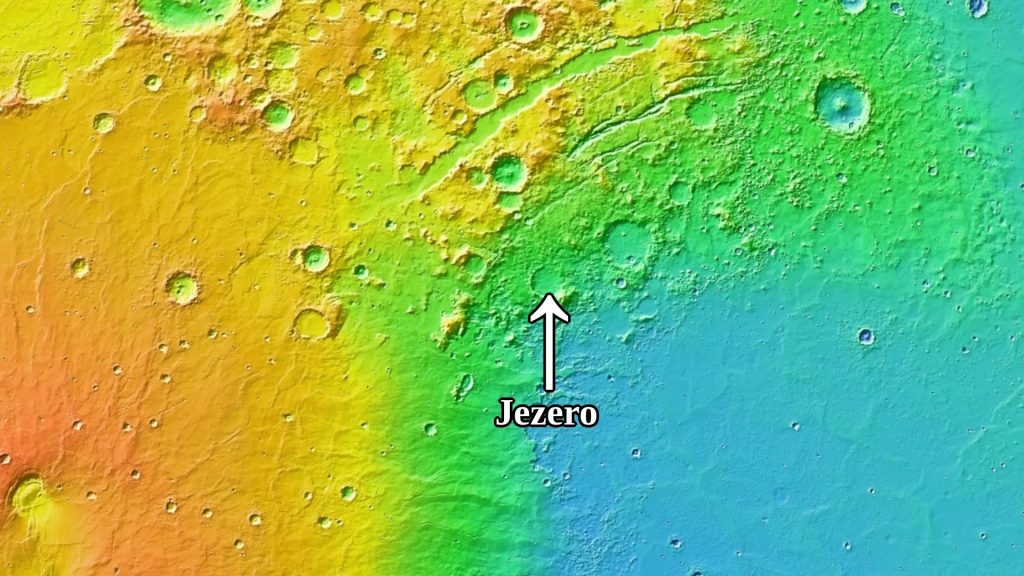
NASA’s Perseverance Rover landed right at the edge of the Syrtis Major shield volcano. Where it almost begins at the crater called Jezero which is 2 kilometers below the Martian datum and about 4 kilometers below the top of the shield volcano. The Rover did capture a bit of the dark surface that is in the region. The crater where the perseverance over landed is right at the edge of the Syrtis Major volcano and also right at the edge of massive plane.
It is estimated that the plane formed 4.2 billion years ago. So it is by around 700 million years older than the Syrtis Major volcano. The plane is nearly -4 km below the Martian datum and it is almost like an extension to the large Borealis Basin. However, it clearly formed as a separate impact crater in the transitional section between the two regions. The terrain shaped by lava flows is clearly visible.
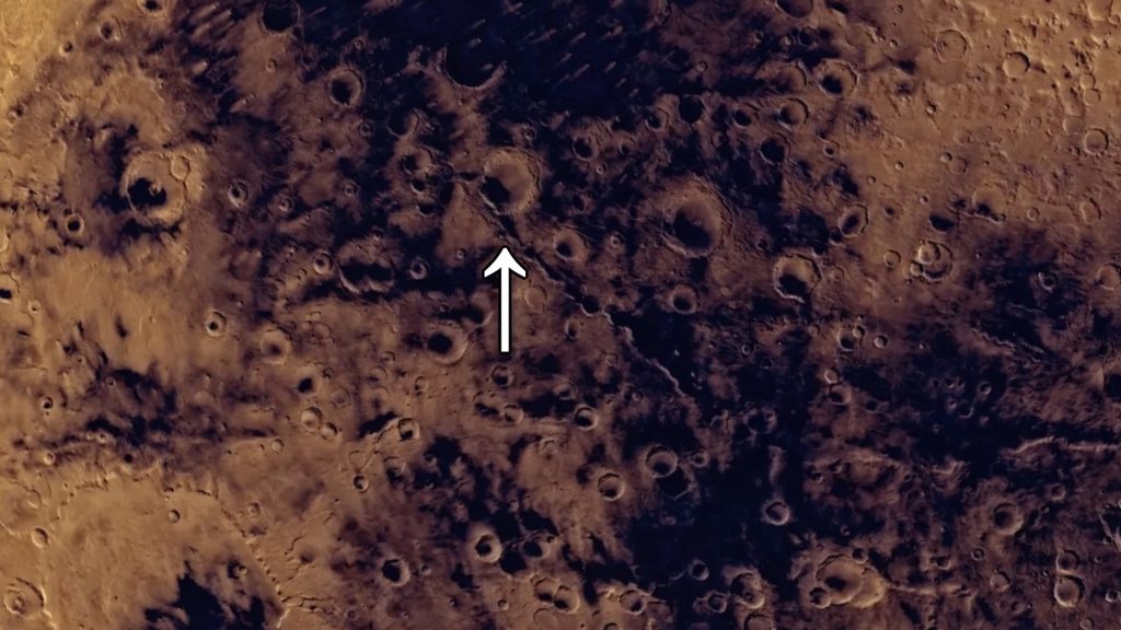
In some places the elevation is gradual between the two regions while in others quite sharp. The dark patch extends beyond the shield volcano, more than half of it is in the southern hemisphere. This part however is much more cratered and in the midst of these large craters, there is large mountain range as seen in the image above going in a straight line. It is visible quite well through a topographic map. It stretches for about 600 kilometers, it is very approximately around 1 kilometer above the surrounding terrain.
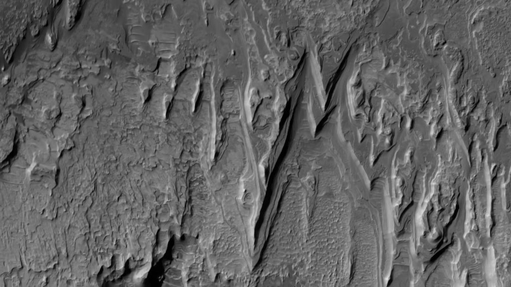
There is also seemingly an extension to this mountain range. There is not much information with regards to what caused the formation of this odd feature. Above is an image captured by NASA’s Mars Reconnaissance Orbiter. It shows how one part of these mountain ranges looks like. There are plenty of these thin bright patches of surface. They are likely exposed hydrated minerals, they are minerals which have water in their structure.
This is known through the measurement of light waves bouncing off of the surface of the minerals. The light waves were captured through a spectrometer device measuring visible and infrared light waves and yes this is another piece of evidence for the existence of liquid water in the past on Mars.
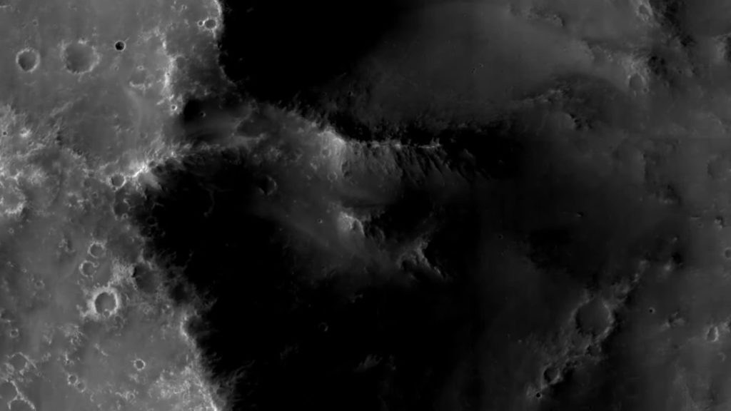
Besides the shield volcano and the mountain range, another characteristic part of the dark patch is the elevation. It is consistently some 2 kilometers above the Martian datum. Above is one image of a center of a crater that is in the region. It has the odd stack of layers that is being eroded. Dark patches on Mars are even visible from Earth through an amateur telescope and yet not much is known as to why these huge regions occur in the places they do.
One reason behind why the surface in those regions is so dark is because the basaltic rock of the region is exposed. Meaning that it is not very dusty there compared to other Martian regions. Basalt is a magnesium and iron rich rock that forms when a very liquid lava quickly cools down. However, the surface there is although somewhat Rocky, still probably not smooth, rather it likely has tons of fine grained dark soil.
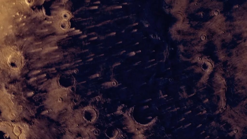
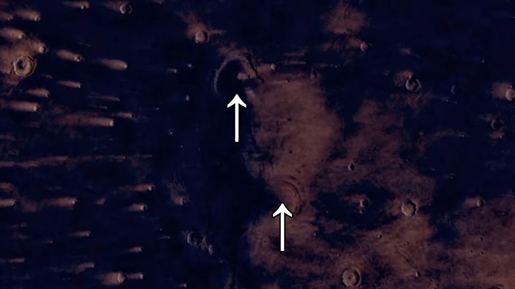
So the question is what caused this region and other dark regions to lack the bright Martian dust? One characteristic feature of the Syrtis Major patch is the bright lines next to Craters that all go in a similar direction. These are called bright wind streaks as seen in the image above, although rare on Earth on Mars and especially here they are very common.
These bright wind streaks also might reveal the reason behind why the surface here is so dark. So wind streaks form due to raised rims of craters which when wind encounters can cause for the wind to either deposit more bright dust which would create bright wind streaks or it could also do the opposite that is clean the surface from the dust and then reveal the darker surface underneath creating dark wind streaks.
These wind streaks also tell us in which direction is the wind blowing or at least in which direction the wind was predominantly blowing at some point in the past. Maybe relatively strong or consistent winds blowing in a single direction Over many years is the reason behind why this dark spot and other dark spots form. The wind simply could have lifted the light bright Martian dust particles and with that exposed the darker soil underneath the surface.